
The Tomorrow.io REST Weather API provides the following fields:
| Field | (Metric, Imperial) | Availability |
|---|---|---|
Convective Available Potential Energy- Quantifies the amount of energy available for rising air parcels, indicating the potential strength of thunderstorm updrafts. | J kg⁻¹ | F: [-7 days, +8 days] I: T M I R A: WW S: ∧ ∨ ~ ⧖ P: - 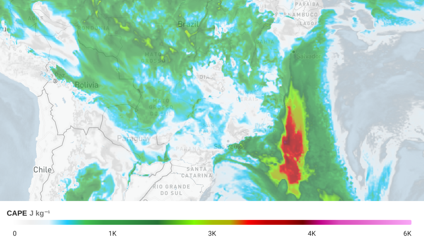 |
Convective Inhibition- Measures the energy barrier that suppresses rising air, indicating how strongly convection is capped. | J kg⁻¹ | F: [-7 days, +8 days] I: T M I R A: WW S: ∧ ∨ ~ ⧖ P: - 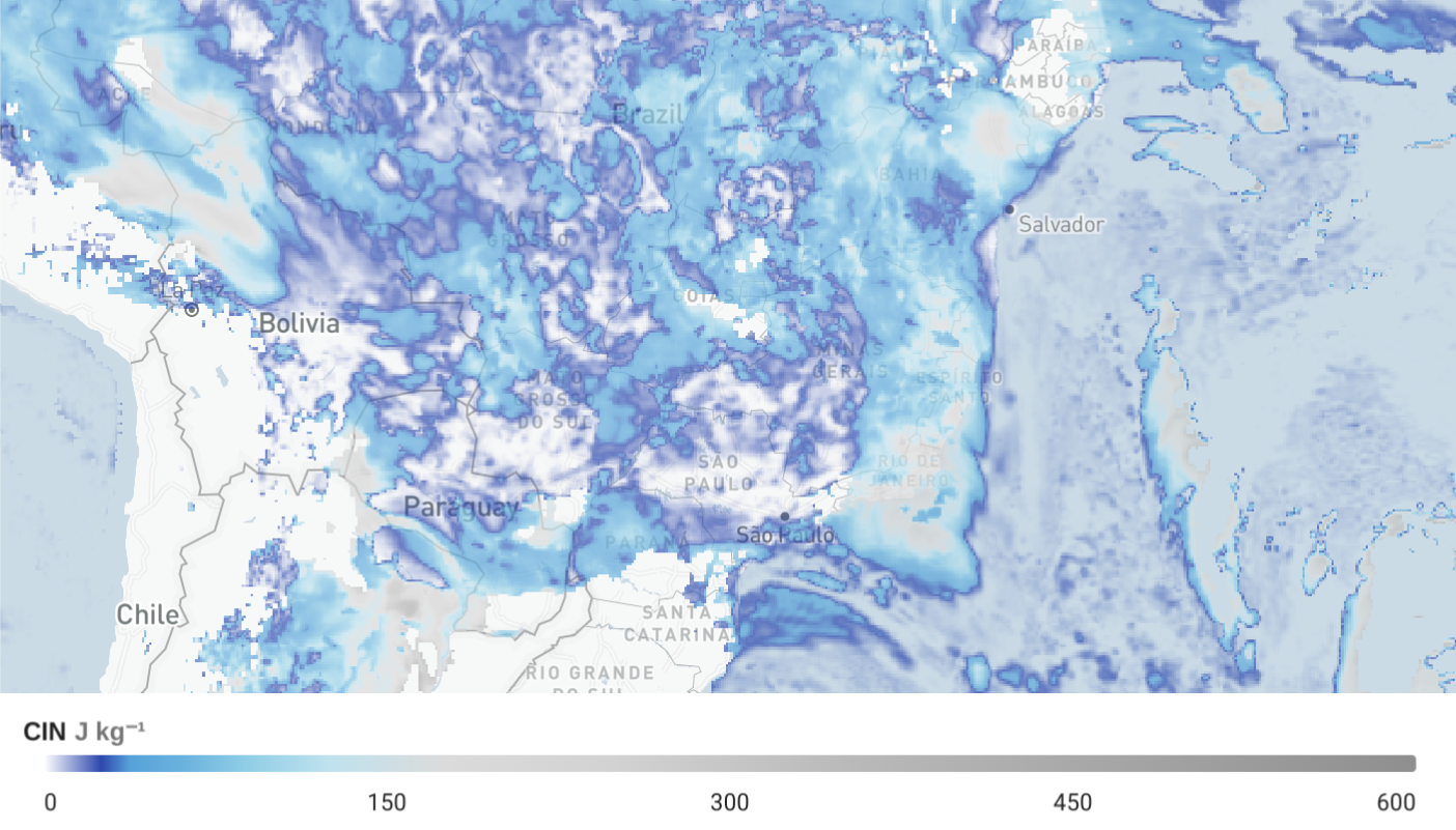 |
Represents the total amount of water vapor in a vertical column of the atmosphere, indicating the potential for heavy rainfall. | mm | F: [-7 days, +8 days] I: T M I R A: WW S: ∧ ∨ ~ ⧖ P: - 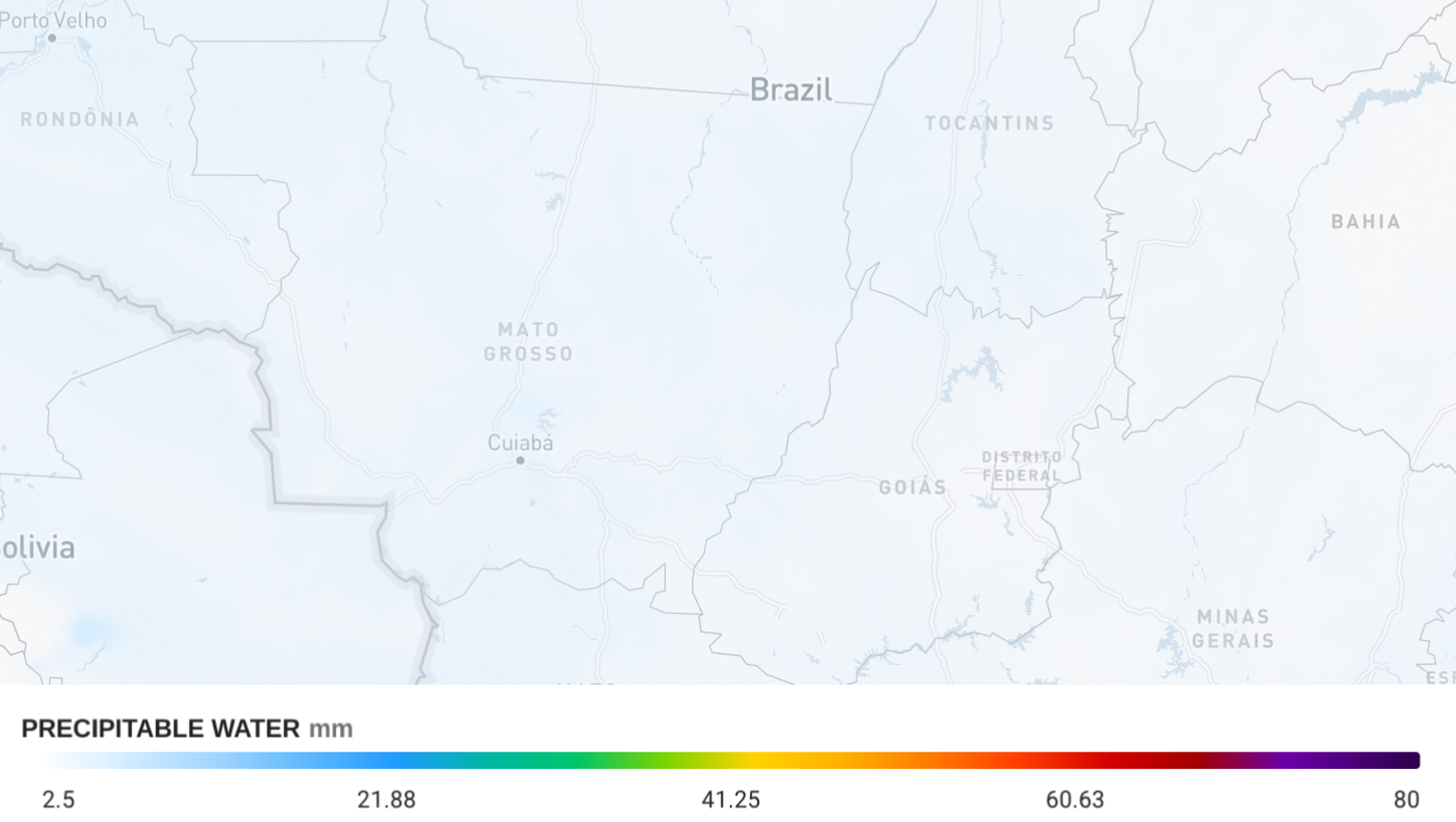 |
Measures the total water vapor integrated through the atmosphere, commonly used to track moisture transport and atmospheric rivers. | mm | F: [-7 days, +8 days] I: T M I R A: WW S: ∧ ∨ ~ ⧖ P: - 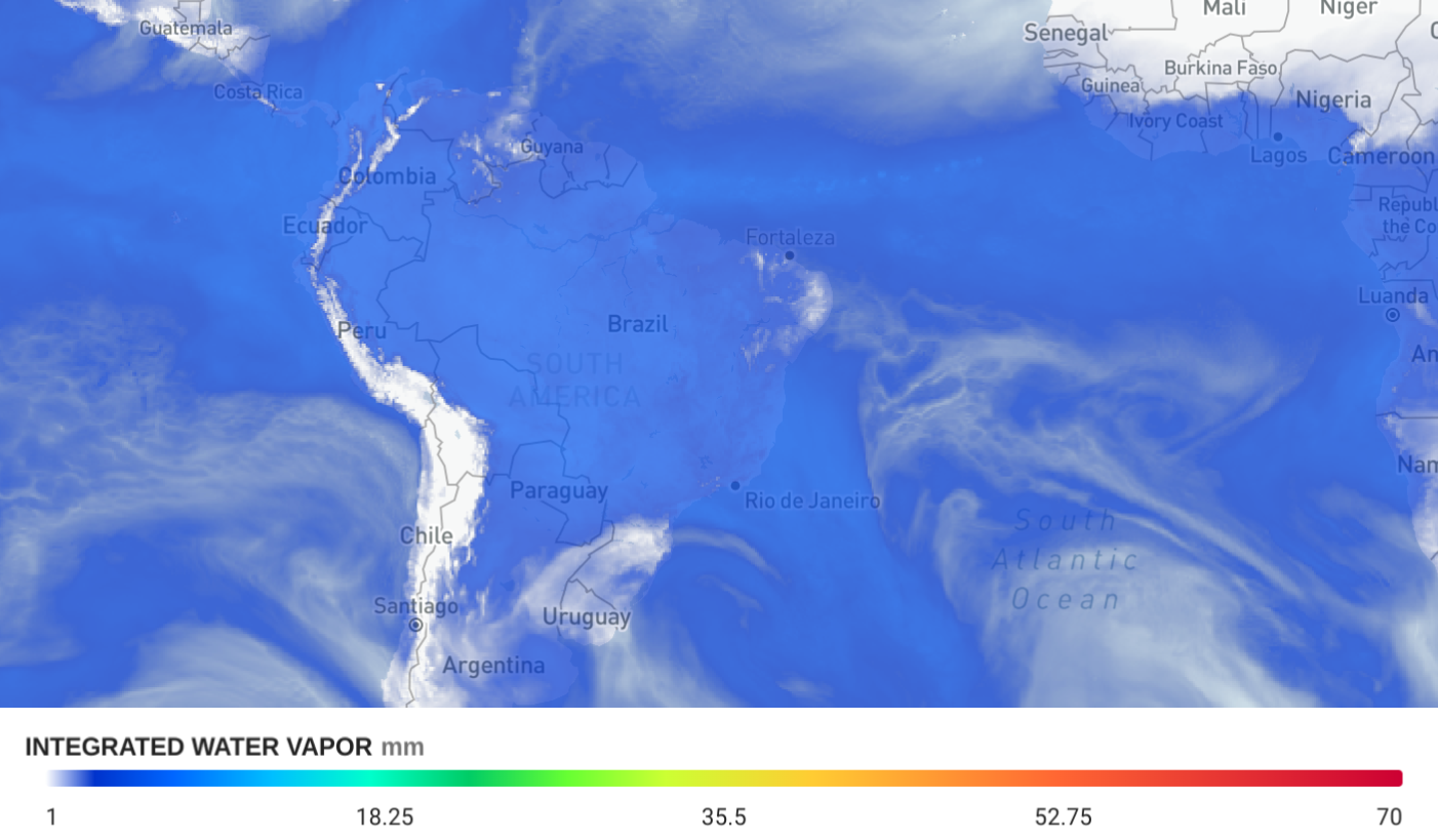 |
Vertical Velocity at 700 hPa. Indicates the upward or downward motion of air, helping identify regions of rising air that support clouds and precipitation or sinking air that suppress them. | Pa s⁻¹ | F: [-7 days, +8 days] I: T M I R A: WW S: ∧ ∨ ~ ⧖ P: - 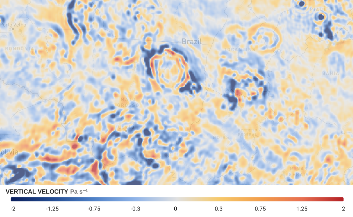 |
Vorticity at 500 hPa. Measures the rotation of air in the atmosphere, highlighting areas of spin associated with troughs, ridges, and storm development. | 10⁵ s⁻¹ | F: [-7 days, +8 days] I: T M I R A: WW S: ∧ ∨ ~ ⧖ P: - 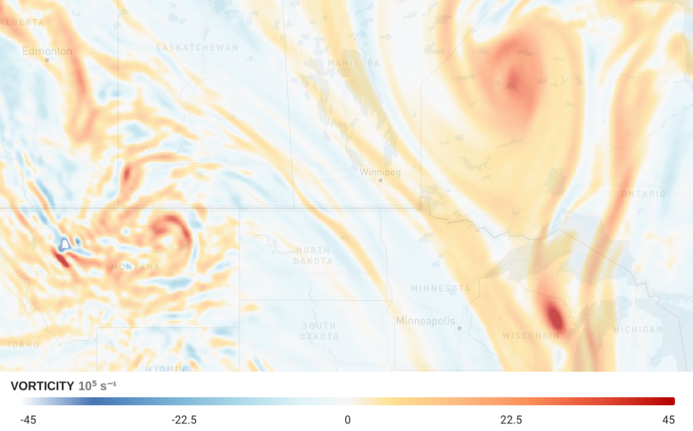 |
Describes the horizontal spreading or converging of air, where upper-level divergence supports rising motion and surface convergence can initiate storms. | 10⁵ s⁻¹ | F: [-7 days, +8 days] I: T M I R A: WW S: ∧ ∨ ~ ⧖ P: - 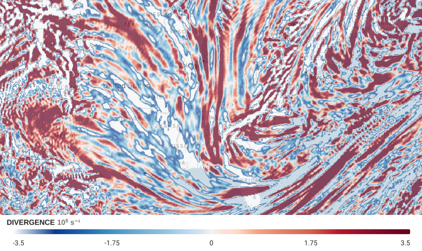 |